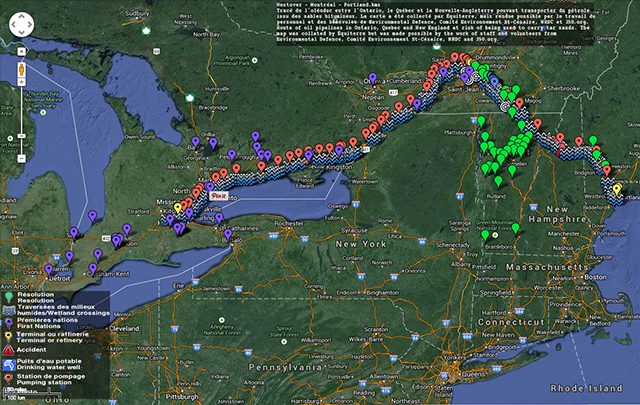
Enbridge is proposing to reverse the flow of its 9B pipeline from North Westover (Ontario) to Montreal. If its application to the National Energy Board is accepted, tar sands oil could soon flow to Quebec and possibly on to Portland, Maine passing through Montérégie, Basses-Laurentides, Lanaudière, Laval , Montreal and the Eastern Townships.
Equiterre, in collaboration with its partners Environmental Defence, The Environmental Committee of St-Césaire, 350.org and NRDC, have developed a map to enable the citizens of Ontario, Quebec and the northeastern United States to know the exact route of the pipeline.
The map highlights the location of past spills, wetland and river crossings, First Nation communities, communities which have adopted a resolution and drinking water wells.
Do not hesitate to contact Geneviève Puskas, Research Officer, to add additional information to the map or to learn how to integrate it to your website: email, 514-522-2000, ext 298.